ODP Legacy > Scientific Results > Leg Summaries > Leg 176 >
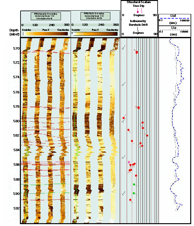
FMS image showing the bottom most 25 m logged interval that includes structural features and lithological boundaries. This figure also includes a depth scale in mbsf; dynamic and static processed FMS images; borehole drift and structural dips and azimuth; deep and shallow resistivity logs from the DLL.
Program administration |
Scientific results |
Engineering & science operations |
Samples, data, & publications |
Outreach |
Overview |
Site map |
Search |
Home
For comments or questions, please contact webmaster@iodp.tamu.edu.
Copyright Consortium for Ocean Leadership