ODP Legacy > Scientific Results > Leg Summaries > Leg 198 >
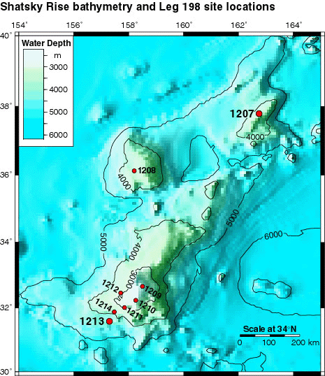
Bathymetric map of Shatsky Rise, showing the South, Central, and North Highs, and the location of the drill sites. Sites 1207 and 1213 were logged.
Program administration |
Scientific results |
Engineering & science operations |
Samples, data, & publications |
Outreach |
Overview |
Site map |
Search |
Home
For comments or questions, please contact webmaster@iodp.tamu.edu.
Copyright Consortium for Ocean Leadership